| Home Page | Buying | Maps | Books | Prints | Ephemera |
- Home Page
- Asia, the Continent
- Middle East
- Far East
- India and Central Asia
1,500 maps reduced in price
All our maps are Originals, NOT modern reproductions
Now all our maps have thumbnails as well as larger images so finding what you want is quicker.
If you want several items, email me for a discount!
Email: don@theoldmapman.com
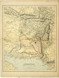 Afghanistan, Baloochistan Anon c 1875 - 23 x 28 cm Shows camel routes. E.g. Thirteen days journey for laden Camels Mountainous Road. Printed colour. Larger image Ref as03 : £10 Return to Asia Index |
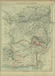 Afghanistan, Baluchistan. Verso: Siam, Cambodia, etc. W & A K Johnston 1896 - 22 x 27 cm Includes British Baluchistan. Verso: Siam, Anam, Cambodia, Cochin China & Tong King. Two images available. Larger image 1 : Larger Image 2 Ref as02 : £8 Return to Asia Index |
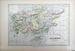 Asia Minor Bartholomew; Wm Collins c1875 - 22 x 15 cm An original antique coloured map. Larger image Ref as140 : £8 Return to Asia Index |
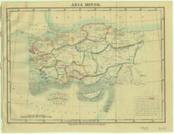 Asia Minor J Dower for Beeton 1868 - 23 x 18 cm Ancient regions hand coloured in outline with the seven Apocalyptic Churches underlined. Larger image Ref as39 : £7 Return to Asia Index |
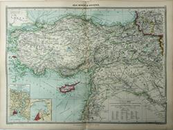 Asia Minor & Armenia Geo. Philip c1907 - 48 x 35 cm Very large double page coloured map, with centrefold. Insets of the Bosphorus & Smyrna. Larger image Ref as146 : £12 Return to Asia Index |
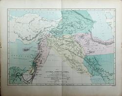 Assyria, Armenia & Syria W Hughes c1865 - 24 X 17 cm Original antique map with hand wash colouring, on light weight paper. Centrefold as issued. Biblical references. Larger image Ref as153 : £10 Return to Asia Index |
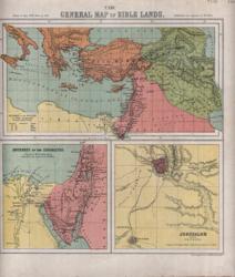 Bible Lands Bartholomew 1866 - 21 x 24 cm General Map and Plan of Jerusalem and Journeys of the Israelites. Printed colour. Larger image Ref as55 : £8 Return to Asia Index |
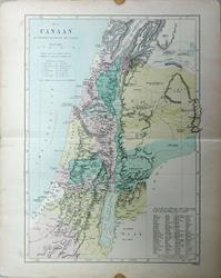 Canaan W Hughes c1865 - 17 x 24 cm Original antique map with hand wash colouring, on light weight paper. Centrefold as issued. Biblical references. Larger image Ref as154 : £9 Return to Asia Index |
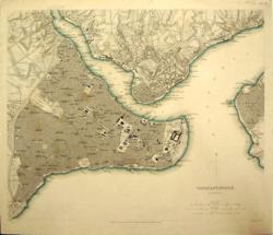 Constantinople SDUK 1840 - 39 x 22 cm Stambool. A fine plan of the city, the Golden Horn, Ghalata, the Bosphorus and part of Skutari. Clearly delineated streets, buildings, etc. The Serai (Top Kapi) is drawn in plan as are the principal mosques. The coast is coloured by hand in outline as issued. Larger image Ref as73 : £40 Return to Asia Index |
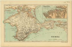 Crimea Bartholomew 1885 - 24 x 14 cm Detailed map of the Crimea with inset of Sebastopol according to an original Russian plan. Printed colour. Larger image Ref as14 : £8 Return to Asia Index |
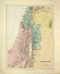 Holy Land Ed. Stanford 1882 - 24 x 33 cm Some hand wash colour. Larger image Ref as59 : £10 Return to Asia Index |
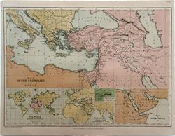 Middle East. Countries Mentioned in the Bible. W & R Chambers 1868 - 31 x 22 cm The map of the area from Italy to the Caspian Sea, the Red Sea and the Persian Gulf. Fine early colour printing. Insets include the world peopled by the descendants of Noah and one of the supposed Situation of Paradise. Centrefold as issued. Larger image Ref as113 : £10 Return to Asia Index |
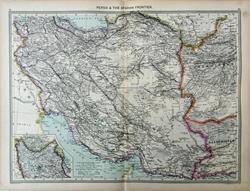 Persia & the Afghan Frontier Geo. Philip c1907 - 48 x 35 cm Very large double page coloured map, with centrefold. Inset of Azerbaijan. Larger image Ref as149 : £12 Return to Asia Index |
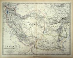 Persia and Afghanistan Keith Johnston 1861 - 58 x 44 cm A fine large map of these fascinating countries with much detail of the historical make up of the nations. Covers from Mt Ararat to Haidarabad and from Bahrain to East of Samarkand. Superb hand-colouring in outline as issued makes this a beautiful map which is in very good condition. Larger image Ref as85 : £25 Return to Asia Index |
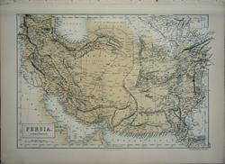 Persia and Afghanistan Sidney Hall 1859 - 38 x 26 cm Coloured map of the two countries and most of modern Pakistan, shown as Beloochistan and Bokhara. Larger image Ref as107 : £10 Return to Asia Index |
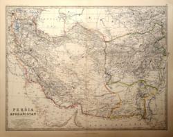 Persia and Afghanistan W & A K Johnston 1881 - 57 x 44 cm With Beluchistan and part of Turkestan. Very large double page map with centrefold and fine outline colouring, . Larger image Ref as76 : £16 Return to Asia Index |
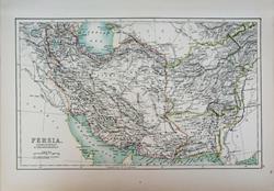 Persia, Afghanistan & Beloochistan Adam and Charles Black's General Atlas of the World. 1895 - 41 x 25 cm Large coloured map, elegantly coloured in outline. Larger image Ref as150 : £11 Return to Asia Index |
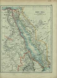 Red Sea. Verso: Persia W & A K Johnston 1896 - 20 x 26 cm A very detailed map of the lands on both sides of the Red Sea together with the routes of the submarine telegraph cables through the Red Sea. Verso: Persia divided in regions including Azerbijan. Two images available. Larger image 1 : Larger Image 2 Ref as38 : £9 Return to Asia Index |
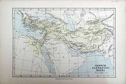 Regnum Alexandri magni. Bartholomew; Wm Collins c1875 - 22 x 15 cm An original antique coloured map. Larger image Ref as142 : £8 Return to Asia Index |
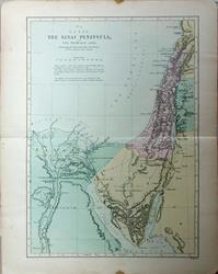 The Sinai Peninsula and the Promised Land W Hughes c1865 - 17 x 24 cm Original antique map with hand wash colouring, on light weight paper. Centrefold as issued. Biblical references. Larger image Ref as155 : £9 Return to Asia Index |
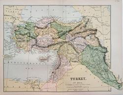 Turkey in Asia Wm. MacKenzie c1880 - 31 x 22 cm Coloured map with the boundaries as set by the Treaty of Berlin (1878). The map includes the valley of the Euphrates named Aljezira and Koordistan Irak Arabi. Centrefold as issued. Larger image Ref as111 : £10 Return to Asia Index |
|||
| |||