| Home Page | Buying | Maps | Books | Prints | Ephemera |
- Home Page
- England & Wales County Maps Anglesea - Dorset
- England & Wales County Maps Durham - Merioneth
- England & Wales County Maps Midd'x - Somerset
- England & Wales County Maps Staffs - Yorks
- British Isles: Physical, Railways, Statistical, etc. Roman Britain
- England & Wales, Countries, Islands, Regions inc. the Lake District, Road & Rail Maps
- Scotland, the Country & Regions: Town Plans & Environs; Rail Maps
- Ireland, the Country, Regions & Environs
- England & Wales, Town Plans & Maps of Environs
- Ordnance Survey and Folding Maps
There are 10 pages of maps of the British Isles. Please see the index on the Great Britain page to gain access to 1000 maps of England, Wales, Scotland and Ireland.
All our maps are Originals, NOT modern reproductions and have thumbnails as well as larger images so it is easy to find what you are looking for.
If you want several items, email me for a discount!
Email: don@theoldmapman.com
> Section 1 > Section 2 > Section 3
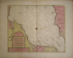 Antique chart of the Channel: The Dover Straights Van Keulen (Johannes). c1666 - 52 x 62 cm The New Sea Map of the First Part of the Channell betwext England et France. Engraved map with original hand colouring; an elaborate strapwork cartouche with the map title in Dutch, French, English, Spanish & Italian; a compass rose and numerous rhumb lines. It is unusually oriented to the West. The map in fact covers the Channel from the Pas de Calais almost as far as Bayeux in Western Normandy and on the English side from Dover almost as far as Selsey Bill. On the English coast towns shown from Dover Westward include Hythe, Rye, Hastings, Brighton, Shoreham and Middleton and many more. On the French side the towns marked include Calais, Montreuil, St Valery, Dieppe, Le Havre, the Seine (as far as Rouen), Caen and Port-en-Bessin. This particular chart of the eastern Channel appears to be very uncommon and currently Internet searches have found only one copy for sale at €495! The map is printed on three conjoined sheets of heavy paper and is in a strong and excellent state. The margins are very wide. 515 x 620 mm. Larger image 1 : Larger Image 2 Ref uk1139 : £185 Return to Great Britain & Ireland Index |
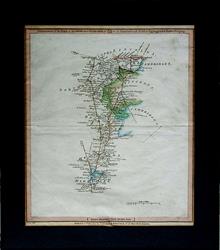 Barnet, Hicks Hall & St. Albans to Stamford, Uppingham & Market Deeping. Laurie & Whittle 1806 - 33 x 38 cm Road map. Commencement of the Roads to Glasgow and Edinburgh as far Stamford, Uppingham & Market Deeping. Routes cover Hitchin, Bedford, Kettering, Baldock, Huntingdon & Peterborough, etc. In a dark green mount 330 x 380 mm with mount window 255 x 305 mm. Hand coloured as issued. Centrefold and a few creases. Two margins are relatively narrow Larger image Ref uk1681 : £40 Return to Great Britain & Ireland Index |
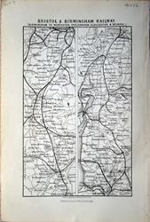 Bristol & Birmingham Railway: Birmingham to Worcester, Cheltenham, Gloucester & Bristol J Bartholomew 1883 - 9 x 14 cm For A & C Black's Guide to England & Wales Larger image Ref uk1186 : £3 Return to Great Britain & Ireland Index |
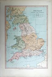 Britain under the Romans Bartholomew; Wm Collins c1875 - 15 x 22 cm An original antique coloured map. Larger image Ref uk1666 : £8 Return to Great Britain & Ireland Index |
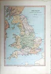 Britain under the Saxons Bartholomew; Wm Collins c1875 - 15 x 22 cm An original antique coloured map. Larger image Ref uk1665 : £8 Return to Great Britain & Ireland Index |
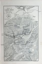 Cader Idris Chart. For A & C Black's Picturesque Guide to Wales 1881 - 11 x 14 cm Original antique map. Larger image Ref uk1716 : £4 Return to Great Britain & Ireland Index |
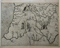 Cardiganshire, Montgomeryshire and Radnorshire. Michael Drayton 1612-22 - 35 x 28 cm Movntgomery Shyre, Cardygan Shyre & Radnor Shyre from Michael Drayton's fantastical poem, the Polyolbion. The Poly-Olbion is divided into thirty songs, written in alexandrine couplets, consisting in total of almost 15,000 lines of verse. Each song describes between one and three counties, describing their topography, traditions and histories. Copies were illustrated with maps of each county, drawn by William Hole, whereon places were depicted anthropomorphically. (thanks, Wikipedia). 430 x 350 mm overall in the ivory bevelled cut mount. The printer was careless with the freshly pressed sheet resulting in some ink marks, mainly in the lower right portion of the map. See images. Larger image 1 : Larger Image 2 : Larger Image 3 Ref uk1684 : £170 Return to Great Britain & Ireland Index |
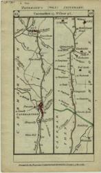 Carmarthenshire Paterson's Roads; Carrington Bowles 1785 - 9 x 17 cm 2 hand coloured strip maps each side from nr Brecon via Llan(ymd)dovery to Caermarthen and 28 miles beyond. Two images available. Larger image 1 : Larger Image 2 Ref uk061 : £12 Return to Great Britain & Ireland Index |
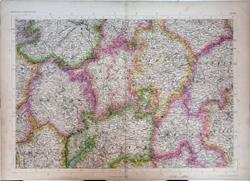 Central England. The Imperial Map of England & Wales John Bartholomew, F.R.G.S. A Fullarton & Co. London & Edinburgh. 1868 - 69 x 49.5 cm Original antique map with original hand colouring of the county boundaries as issued. The Imperial Map of England & Wales according to the Ordnance Survey, with the latest additions; shewing clearly every feature of the country, railways and their stations, Roads, Canals, Rivers, Gentlemen's Seats, &c. &c. On the Scale of 4 Miles to an Inch. Closed split on lowest 8 cm of the centrefold. Larger image 1 : Larger Image 2 Ref uk1730 : £25 Return to Great Britain & Ireland Index |
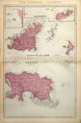 Channel Islands G W Bacon 1887 - 30 x 47 cm Large double page hand coloured map as issued with woods, parks, hills, roads and railways. On one page a map of Jersey and on the other a map of Guernsey, Herm and Sark with an inset map of Sark. All on the scale of approx three-quarters of an inch to the mile. Larger image Ref uk462 : £15 Return to Great Britain & Ireland Index |
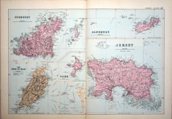 Channel Islands & Isle of Man G W Bacon c 1885 - 46 x 30 cm Large double page hand coloured map as issued with woods, parks, hills, roads and railways. On one page maps of Jersey and Alderney; on the other a map of Guernsey, Herm and Jethou and a separate map of Sark; all on the scale of approx three-quarters of an inch to the mile. Also a map of the Isle of Man at 5 miles to an inch. Larger image Ref uk925 : £15 Return to Great Britain & Ireland Index |
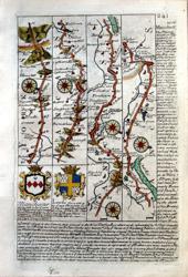 Cheshire, Lancashire, Yorkshire Bowen, Owen 1720/64 - 12 x 18 cm Hand coloured strip map Riponden (sic) to Manchester and Warrington with descriptions of Manchester and Haulton (sic) & on verso Frodsham to Warrington to Chester and Manchester to Stopford (now Stockport) and Disley (Dean) with description of Warrington. 4 Coats of Arms. There is a closed tear in the inner margin. Two images available. Larger image 1 : Larger Image 2 Ref uk1025 : £24 Return to Great Britain & Ireland Index |
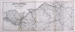 Chester & Holyhead, Chester & Shrewsbury Railway. For A & C Black's Picturesque Guide to Wales 1881 - 37 x 14.5 cm Original antique map. Five folds as issued. One fold strengthened covering a small hole in a blank area, west of Wrexham. Larger image 1 : Larger Image 2 Ref uk1714 : £12 Return to Great Britain & Ireland Index |
 Cornwall & S.W. Devon. The Imperial Map of England & Wales. John Bartholomew, F.R.G.S. A Fullarton & Co. London & Edinburgh. 1868 - 74 x 26 cm Original antique map with original hand colouring of the county boundaries as issued. The Imperial Map of England & Wales according to the Ordnance Survey, with the latest additions; shewing clearly every feature of the country, railways and their stations, Roads, Canals, Rivers, Gentlemen's Seats, &c. &c. On the Scale of 4 Miles to an Inch. Larger image 1 : Larger Image 2 Ref uk1735 : £25 Return to Great Britain & Ireland Index |
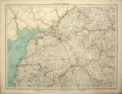 Cumberland, with parts of Northumberland, Durham & Westmorland. Carlisle Bartholomew c1898 - 42 x 32 cm As far North as Bellingham, East to Hexham and South to Kirby Stephen. Finely printed map of the area with County boundaries, roads, woods and lakes in colour. Four miles to the inch. From Royal Atlas of England & Wales. Stain in the outer margin on two corners. Larger image Ref uk395 : £6 Return to Great Britain & Ireland Index |
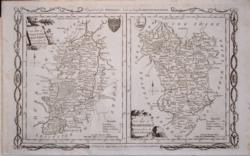 Derbyshire & Nottinghamshire Alex'r Hogg, Thomas Conder 1784/1794 - 35 x 22 cm Uncoloured map of the two counties on the same sheet. There is a closed tear in the very bottom of the map of Nottinghamshire where it just cuts the frame. Larger image 1 : Larger Image 2 Ref uk1133 : £45 Return to Great Britain & Ireland Index |
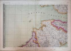 Devon and the Bristol Channel; parts of Glamorganshire, Somerset and Cornwall. The Imperial Map of England & Wales. John Bartholomew, F.R.G.S. A Fullarton & Co. London & Edinburgh. 1868 - 69 x 49.5 cm Original antique map with original hand colouring of the county boundaries as issued. The Imperial Map of England & Wales according to the Ordnance Survey, with the latest additions; shewing clearly every feature of the country, railways and their stations, Roads, Canals, Rivers, Gentlemen's Seats, &c. &c. On the Scale of 4 Miles to an Inch. Larger image 1 : Larger Image 2 Ref uk1734 : £22 Return to Great Britain & Ireland Index |
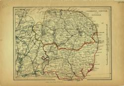 East Anglia Charles Knight 1852 - 21 x 16 cm Cambridgeshire, Norfolk & Suffolk. Original fine outline colouring. Many railway lines. Larger image Ref uk074 : £12 Return to Great Britain & Ireland Index |
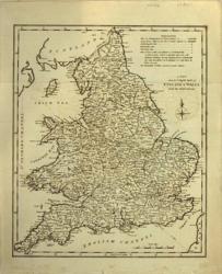 England & Wales Anon 1800/17 - 23 x 28 cm Uncoloured map showing counties and principal towns. Compass rose. Very slight off-setting. Original folds. Larger image Ref uk226 : £11 Return to Great Britain & Ireland Index |
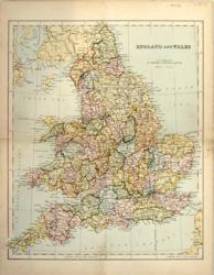 England & Wales Anon c 1875 - 23 x 29 cm Map coloured by county with numerous railways. Centrefold strengthened in part. Smudge at foot. Larger image Ref uk231 : £4 Return to Great Britain & Ireland Index |
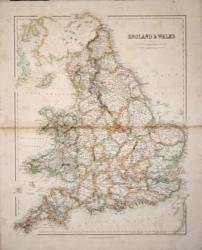 England & Wales Arch'd Fullarton c1850 - 42 x 53 cm Very fine large hand coloured map of England and Wales divided into their Counties with delicate wash boundaries in pastel shades. Very slight toning of the paper only noticeable in the surrounding seas although slightly more obvious along the centrefold. Larger image Ref uk206 : £15 Return to Great Britain & Ireland Index |
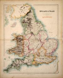 England & Wales Arch'd Fullarton c1850 - 42 x 53 cm Very fine large hand coloured map of England and Wales divided into 7 Regions and subdivided into their Counties with delicate wash boundaries in pastel shades. This map also has, superimposed in red over the Regions, geographers' descriptions of the Hills and Mountains of the British Isles, e.g. Cambrian Range. Larger image Ref uk207 : £28 Return to Great Britain & Ireland Index |
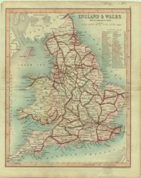 England & Wales Archer for Dugdale 1850 - 19 x 24 cm Original wash colouring with railways in red. Larger image Ref uk130 : £10 Return to Great Britain & Ireland Index |
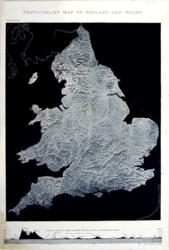 England & Wales Bartholomew N.D. - 21 x 32 cm Photo-relief map with Vertical Section across England & Wales on an exaggerated (sic) scale. The lower left corner is stained outside the photo-map but touches the end of the Section. Larger image Ref uk235 : £6 Return to Great Britain & Ireland Index |
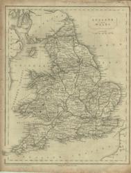 England & Wales Becker, Geo Virtue 1840 - 21 x 26 cm Uncoloured map showing counties, principal towns and railways. Narrow right margin. Larger image Ref uk132 : £8 Return to Great Britain & Ireland Index |
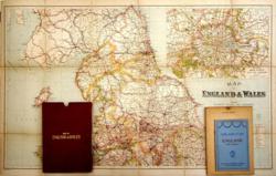 England & Wales Chart Publishing Co. c 1935 - 101 x 62 and 101 x 73 cm Very large folding map on two sheets. The map is dissected into 36 sections and laid down on cloth. Showing Railways, Roads, and Distances. 27 railway companies named and the railway network is especially well brought out on the map. Booklet Index Guide to Map included. Very good condition. Larger image Ref uk701 : £18 Return to Great Britain & Ireland Index |
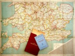 England & Wales Chart Publishing Co. c 1928 - 101 x 62 and 101 x 73 cm Very large folding map on two sheets . The map is dissected into 36 sections and laid down on cloth. Showing Railways, Roads, and Distances. 29 railway companies named and the railway network is especially well brought out on the map. Booklet Index Guide to Map included. Good condition. Larger image Ref uk702 : £18 Return to Great Britain & Ireland Index |
 England & Wales Geo Philip & Son 1856 - 23 x 30 cm Uncoloured relief map showing counties and principal towns with the Railways, showing the vast rail network at that time. Also states that the navy has 671 ships! Good margins and very clean. Larger image Ref uk229 : £15 Return to Great Britain & Ireland Index |
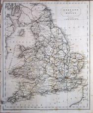 England & Wales Geo. Virtue & Co c1845 - 21 x 26 cm Uncoloured map showing early railways. Engraved by the Becker Omnigraph. Original folds and shaved top margin (see image). A little light spotting. Short closed edge tear. Larger image Ref uk1082 : £4 Return to Great Britain & Ireland Index |
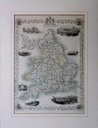 England & Wales J & E Tallis. Map drawn & engraved by J Rapkin. The illustrations drawn by N Whittock and engraved by J Rogers. 1851 - 26.5 x 37 cm Original antique map with original hand colouring of the county boundaries as issued. Vignettes of London, Oxford, Portsmouth Harbour, Sunderland Bridge, Newcastle-upon-Tyne, Doncaster Races and Hunting. The border is topped by the Royal coat of arms and with drawings in the corners showing agriculture, commerce, science and the arts. Early edition without centrefold. Full margins all round. Toned verso but not showing on the face. Sold with ivory bevelled mount and a single ruling. Mount window 25.5 x 35.5. Overall size 35.5 x 45.5. The size of the mount makes it a Medium Parcel so shipping in UK £6. Shipped without mount, if preferred. Larger image Ref uk1719 : £90 Return to Great Britain & Ireland Index |
 England & Wales J Bartholomew 1874 - 37.5 x 51 cm For A & C Black's Guide to England & Wales; multiple original folds. Larger image 1 : Larger Image 2 Ref uk1595 : £25 Return to Great Britain & Ireland Index |
 England & Wales J Bartholomew for W & R Chambers 1868 - 21 x 26 cm Original antique printed map in colours showing principal features. Centrefold as issued. Larger image Ref uk1658 : £8 Return to Great Britain & Ireland Index |
 England & Wales J Bartholomew, FRGS. Blackie & Son. c1895 - 22.5 x 29 cm Original antique coloured map showing the counties. Centrefold as issued. Larger image Ref uk1774 : £8 Return to Great Britain & Ireland Index |
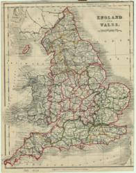 England & Wales John Dower 1868 - 19 x 24 cm Outline colouring of Counties. For Beeton's Dictionary of Geography. No top margin & shaved RH margin. Larger image Ref uk124 : £8 Return to Great Britain & Ireland Index |
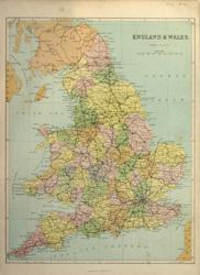 England & Wales Virtue & Co 1873 - 25 x 32 cm Map coloured by county with numerous railways. Marginal repairs. Larger image Ref uk232 : £5 Return to Great Britain & Ireland Index |
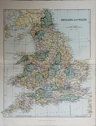 England & Wales Wm. MacKenzie c1885 - 23 x 27.5 cm Original antique coloured map. Centrefold as issued. Railways shown in vast numbers. Larger image Ref uk1711 : £8 Return to Great Britain & Ireland Index |
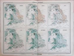 England & Wales Average Rainfall John Bartholomew c1898 - 42 x 33 cm Six monthly maps with rainfall amounts. Information in inches, of course. Larger image Ref uk1812 : £5 Return to Great Britain & Ireland Index |
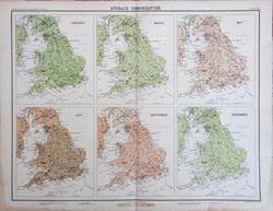 England & Wales Average Temperature John Bartholomew c1898 - 42 x 33 cm Six monthly maps with isotherms indicating highest mean temperatures. Information in degrees Fahrenheit, of course. Larger image Ref uk1813 : £5 Return to Great Britain & Ireland Index |
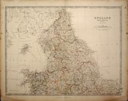 England & Wales: 2 sheets W & A K Johnston 1868 - 43 x 32 ea. cm A pair of maps with the counties hand coloured in outline as issued. Northern Sheet has foxing and water staining in the margins. The Southern sheet has a short repair to the bottom of the centrefold and foxing and water staining in the margins and also a faint water stain near Jersey and faint smudge near Portland Bill. Mounted most of the blemishes would be hidden. Four images available, two showing mounted views. Larger image 1 : Larger Image 2 : Larger Image 3 : Larger Image 4 Ref uk569 : £25 Return to Great Britain & Ireland Index |
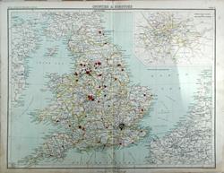 England & Wales: Counties & Boroughs Bartholomew. From Royal Atlas of England & Wales. c1898 - 43 x 34 cm Large double page antique map. The County Boroughs are shown in red. Inset of London County Council and Parliamentary Divisions. Restored short tear on centrefold. Larger image Ref uk1662 : £7 Return to Great Britain & Ireland Index |
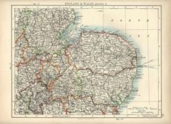 England & Wales: East Anglia. Verso: Wessex W & A K Johnston 1897 - 26 x 20 cm East Anglia bounded by Lincoln, Northampton and Colchester. Verso: Wessex from High Wycombe to Totness (sic) and from Bridgend to Chichester. Fine outline coloured maps. Two images available. Larger image 1 : Larger Image 2 Ref uk706 : £8 Return to Great Britain & Ireland Index |
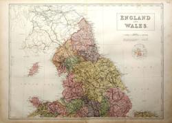 England & Wales: North W. Hughes/ A & C Black 1873 - 56 x 42 cm A large printed colour map of the North of England as far south as The Wash, with the Isle of Man. Shows railways in strong detail. Repair to 2 or 3 cm at bottom of centrefold. Larger image Ref uk642 : £12 Return to Great Britain & Ireland Index |
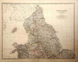 England & Wales: Northern Sheet Keith Johnston 1877 - 57 x 44 cm A very detailed map coloured in outline to resemble hand-colouring. The area covered extends to a line from the River Dovey to Bungay and includes the Isle of Man. Very good condition. Larger image Ref uk643 : £22 Return to Great Britain & Ireland Index |
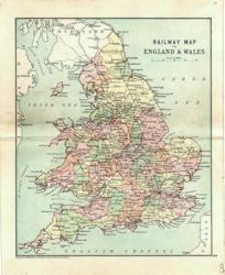 England & Wales: Railway Map Geo. Philip & Son 1889 - 15 x 21 cm Printed colour shewing the Counties and the large number of railway lines. Larger image Ref uk677 : £7 Return to Great Britain & Ireland Index |
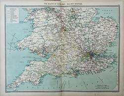 England & Wales: Railway Systems, South. Geo. Philip c1907 - 48 x 35 cm Very large double page coloured map, with centrefold. Table of Reference to track colours of 13 Railway Companies. Larger image Ref uk1668 : £12 Return to Great Britain & Ireland Index |
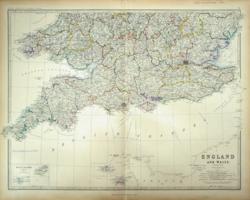 England & Wales: Southern Sheet Keith Johnston 1861 - 59 x 44 cm A very detailed map which extends to a line from the Aberystwyth to Thetford. Superb hand-colouring in outline as issued makes this a beautiful map which is in very good condition. Larger image Ref uk646 : £45 Return to Great Britain & Ireland Index |
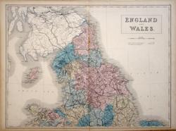 England & Wales: The North Anon 1856 - 55 x 41 cm Hand coloured sheet covering the North of England, the Isle of Man and North Wales, as issued. As far South as Derby, Nottingham and the Wash. Larger image Ref uk565 : £22 Return to Great Britain & Ireland Index |
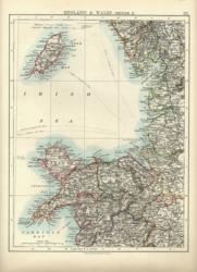 England & Wales: The North West. Verso: South Wales W & A K Johnston 1897 - 20 x 26 cm Lancashire, North Wales and the Isle of Man. Verso: South Wales, Hereford and the Bristol Channel coast. Fine outline coloured maps. Two images available. Larger image 1 : Larger Image 2 Ref uk705 : £7 Return to Great Britain & Ireland Index |
> Section 1 > Section 2 > Section 3 | |||