| Home Page | Buying | Maps | Books | Prints | Ephemera |
- Home Page
- England & Wales County Maps Anglesea - Dorset
- England & Wales County Maps Durham - Merioneth
- England & Wales County Maps Midd'x - Somerset
- England & Wales County Maps Staffs - Yorks
- British Isles: Physical, Railways, Statistical, etc. Roman Britain
- England & Wales, Countries, Islands, Regions inc. the Lake District, Road & Rail Maps
- Scotland, the Country & Regions: Town Plans & Environs; Rail Maps
- Ireland, the Country, Regions & Environs
- England & Wales, Town Plans & Maps of Environs
- Ordnance Survey and Folding Maps
There are 10 pages of maps of the British Isles. Please see the index on the Great Britain page to gain access to 900 maps of England, Wales, Scotland and Ireland.
All our maps are Originals, NOT modern reproductions and have thumbnails as well as larger images so it is easy to find what you are looking for.
ADDED ORDNANCE SURVEY MAPS COVERING WEST LONDON AND SURREY. 62 AT SIX INCH (55 NOW SOLD) AND 20 AT TWO & A HALF INCH SCALE (ALL NOW SOLD). Maps at 6 inches to the mile show individual properties, often with the name of the house. Also shown are names of pubs, farms, churches, (of many denominations) and businesses as well as features like woods, copses, commons, railways and archaeological features. They therefore provide a huge resource for the local historian or interested resident.
ADDED 124 WAR ISSUE OS MAPS at one inch scale (About half now sold). Compare then and now railways, roads and urban change, etc. These maps are priced solely on condition.
If you don't want to wade through them all, email me with the name of the nearest town and I will give you available map numbers.
JUST ADDED 11 MILITARY EDITIONS OF QUARTER INCH SCALE MAPS dated 1940 or 1943. These show and name the many airfields at this time.
If you want several items, email me for a discount!
Email: don@theoldmapman.com
 Clyde Gall & Inglis c1925 - 63 x 38 cm Half Inch Tourists map of The Clyde. Double sided folding map on paper. Ardfern, Inverary, Ben Lomond to the Mull of Kintyre and Ayr with the Isle of Arran and Holy Island centre of the lower section. Short repairs to the ends of the centrefold with transparent tape. List of place names in pencil inside back cover. 630 x 280mm. Probably before 1925. Larger image 1 : Larger Image 2 : Larger Image 3 Ref uk1229 : £9 Return to Great Britain & Ireland Index |
 County of Lancashire W. H. Smith 1880? - 37 x 51 cm Folding map on cloth in 12 sections in cloth covers with label on front board in two colours. The map itself has some hand colouring. Two images available. Larger image 1 : Larger Image 2 Ref uk689 : £30 Return to Great Britain & Ireland Index |
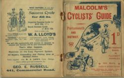 Cyclists' Guide - Portsmouth and District F. Malcolm 1902 - 44 x 28 cm Paper covered booklet with two colour cover (detached and spine title lacking) illustrating cycling and motoring in 1900. Folding paper map covering Dartmoor to Kent and North to the Cotswolds with adverts including one looking for 999,999 maiden ladies! 74 page booklet packed with adverts, illustrations of cycling and cycles and small route maps and itineraries. Two images available. Larger image 1 : Larger Image 2 Ref uk679 : £22 Return to Great Britain & Ireland Index |
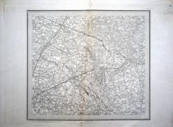 Ordnance Survey Map of Merseyside - Wigan. (89) Ordnance Survey 1843-1861 - 38 x 33 cm This original antique Ordnance Survey sheet is the 1843 edition of this famous 1 to a mile production and was issued in 1861 (from the official embossed stamp). This sheet 89 covers Aughton, Kirkby, Ormskirk, Wigan, Billinge and Upholland. However this map has been mistreated and the blank margins have been slightly trimmed. As can be seen from the image there is a diagonal line where the map has been folded. However this map shows this part of Lancashire as it was 170 years ago. 13.5 x 12 miles at 1 to the mile. Larger image 1 : Larger Image 2 : Larger Image 3 : Larger Image 4 Ref uk1143 : £15 Return to Great Britain & Ireland Index |
 Ordnance Survey Map of Nantwich Rural District Edward Stanford 1900 - 67 x 57 cm A specially produced folding map made up from parts of the one inch sheets 109, 110, etc., showing the Rural District Boundary outlined in red by hand. The District surrounds Crewe and Nantwich both towns being outlined in red. The map indicates that it was revised to 1898. The elements have been pieced and laid down on cloth professionally and the map is in red cloth covers with printed paper label and marbled endpapers. Very good condition. Two images available. Larger image 1 : Larger Image 2 Ref uk693 : £28 Return to Great Britain & Ireland Index |
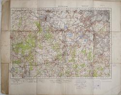 Ordnance Survey Map Windsor, sheet 114 Ordnance Survey 1940 - 84 x 64.5 cm 1 inch to 1 mile. Published at the War Office 1940. Geographical Section, General Staff. No. 3907. Sheet laid down on cloth without covers. Map itself in good condition but margin soiled and verso a little grubby. 840 x 645 mm overall including wide margins. Covers Aldershot, Fleet, Wokingham, Slough, Southall, Hammersmith, Morden, Walton on the Hill. Larger image 1 : Larger Image 2 : Larger Image 3 Ref uk1220 : £6 Return to Great Britain & Ireland Index |
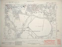 OS Sheet Ashford (Midd'x) Ordnance Survey 1938 - 55.5 x 43 cm Middlesex Sheet XXIV NE; Surrey Parts of Sheets V & XI. Scale 1:10,560 or 6 Inches to 1 Statute Mile. Provisional Edition. Ashford, Laleham, Littleton, Knowle Green, Charlton, Chattern Hill, Queen Mary Reservoir, etc. Surveyed 1864 & 1868-69; Boundaries Revised to 1934-35 & 1934 with additions in 1938. 55.5 x 43cm overall. Covers 3 miles by 2 miles. Uncoloured and in very good condition. Note that although these have updates in 1938 they are still based on the mid nineteenth century survey. Note that these maps are not new and the paper may be toned and have minor signs of use so please inspect the image. Larger image Ref uk1246 : £15 Return to Great Britain & Ireland Index |
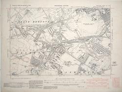 OS Sheet Feltham Ordnance Survey 1938 - 55.5 x 43 cm Middlesex Sheet XX SW. Scale 1:10,560 or 6 Inches to 1 Statute Mile. Provisional Edition. Feltham, Hanworth, Hounslow Heath, huge marshalling yards, East Bedfont, etc. Surveyed 1863-64; Boundaries Revised to 1937 with additions in 1938. 55.5 x 43cm overall. Covers 3 miles by 2 miles. Uncoloured and in very good condition apart from a few thumb marks. Note that although these have updates in 1938 they are still based on the mid nineteenth century survey. Note that these maps are not new and the paper may be toned and have minor signs of use so please inspect the image. Larger image Ref uk1245 : £15 Return to Great Britain & Ireland Index |
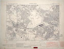 OS Sheet Hayes and Southall Ordnance Survey 1938 - 55.5 x 43 cm Middlesex Sheet XV SW. Scale 1:10,560 or 6 Inches to 1 Statute Mile. Provisional Edition. Hayes, Harlington, Southall, Dawley, Norwood Green, North Hyde, etc. Surveyed 1863 - 65; Boundaries Revised to 1935 with additions in 1938. 55.5 x 43cm overall. Covers 3 miles by 2 miles. Uncoloured and in very good condition. Note that although these have updates in 1938 they are still based on the mid nineteenth century survey. Note that these maps are not new and the paper may be toned and have minor signs of use so please inspect the image. Larger image Ref uk1238 : £15 Return to Great Britain & Ireland Index |
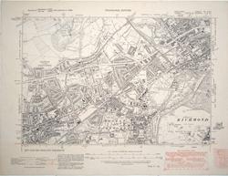 OS Sheet Hounslow and Brentford Ordnance Survey 1938 - 55.5 x 43 cm Middlesex Sheet XX NE; Surrey Parts of Sheets I & VI. Scale 1:10,560 or 6 Inches to 1 Statute Mile. Provisional Edition. Heston & Isleworth, Brentford, Hounslow, Richmond Old Deer Park, Syon Park, etc. Surveyed 1863-66 & 1865-66; Boundaries Revised to 1934 & 1935 with additions in 1938. 55.5 x 43cm overall. Covers 3 miles by 2 miles. Uncoloured and in very good condition. Note that although these have updates in 1938 they are still based on the mid nineteenth century survey. Note that these maps are not new and the paper may be toned and have minor signs of use so please inspect the image. Larger image Ref uk1243 : £15 Return to Great Britain & Ireland Index |
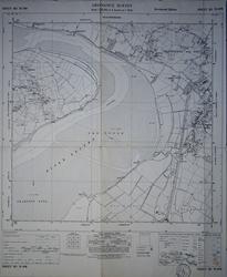 OS Sheet SO 70NW: River Severn - The Noose. Gloucestershire. Ordnance Survey 1955 - 54 x 66 cm 6 inches to 1 mile. Folded sheet laid on linen. Awre, Fretherne with Saul, to Frampton Sands. Larger image Ref uk1212 : £10 Return to Great Britain & Ireland Index |
 OS Sheet ST 55SW: Priddy Circles. Ordnance Survey 1961 - 54 x 66 cm 6 inches to 1 mile. Folded sheet laid on linen. Templedown Farm to Hunter's Lodge. One fold repaired, verso. Larger image Ref uk1213 : £9 Return to Great Britain & Ireland Index |
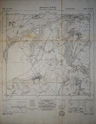 OS Sheet ST 87SW: Colerne, Wiltshire. Ordnance Survey 1955 - 55 x 72 cm 6 inches to 1 mile. Folded sheet laid on linen. The Wraxalls and Ford to Lidbrooks Bottom & Rudloe Larger image Ref uk1209 : £10 Return to Great Britain & Ireland Index |
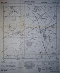 OS Sheet ST 99NE: Kemble, Gloucestershire. Ordnance Survey 1960 - 54 x 66 cm 6 inches to 1 mile. Folded sheet laid on linen. Tarleton to Poole Keynes. Source of the Thames. Larger image Ref uk1210 : £10 Return to Great Britain & Ireland Index |
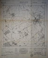 OS Sheet ST 99SE: Tetbury, Gloucestershire. Ordnance Survey 1955 - 55 x 67 cm 6 inches to 1 mile. Folded sheet laid on linen. Beverston to Shipton Moyne. Highgrove House. Larger image Ref uk1211 : £10 Return to Great Britain & Ireland Index |
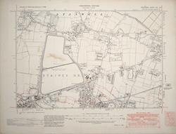 OS Sheet Stanwell Ordnance Survey 1938 - 55.5 x 43 cm Middlesex Sheet XIX SE. Scale 1:10,560 or 6 Inches to 1 Statute Mile. Provisional Edition. Stanwell, Staines Reservoir, East Bedfont, etc. Surveyed 1864; Boundaries Revised to 1934 with additions in 1938. 55.5 x 43cm overall. Covers 3 miles by 2 miles. Uncoloured and in very good condition except for a light stain in Staines Reservoir. Note that although these have updates in 1938 they are still based on the mid nineteenth century survey. Note that these maps are not new and the paper may be toned and have minor signs of use so please inspect the image. Larger image Ref uk1242 : £15 Return to Great Britain & Ireland Index |
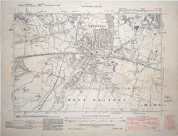 OS Sheet West Drayton Ordnance Survey 1938 - 55.5 x 43 cm Middlesex Sheet XIV SE; Buckinghamshire Parts of Sheets LIII,LIV, LVI & LVII. Scale 1:10,560 or 6 Inches to 1 Statute Mile. Provisional Edition. Yiewsley, West Drayton, Iver, Goulds Green, Thorney, etc. Surveyed 1864 & 1874; Boundaries Revised to 1934-35 with additions in 1938. Printed on War Substitute Paper. 55.5 x 43cm overall. Covers 3 miles by 2 miles. Uncoloured and in good condition but with a few thumbings in the margins. Note that although these have updates in 1938 they are still based on the mid nineteenth century survey. Note that these maps are not new and the paper may be toned and have minor signs of use so please inspect the image. Larger image Ref uk1237 : £15 Return to Great Britain & Ireland Index |
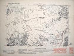 OS Sheet Yeading Ordnance Survey 1938 - 55.5 x 43 cm Middlesex Sheet XV NW. Scale 1:10,560 or 6 Inches to 1 Statute Mile. Provisional Edition. Hayes End, Yeading, Islips Manor Park, West End, etc. Surveyed 1863 - 64; Boundaries Revised to 1936 with additions in 1938. 55.5 x 43cm overall. Covers 3 miles by 2 miles. Uncoloured and in very good condition. Note that although these have updates in 1938 they are still based on the mid nineteenth century survey. Note that these maps are not new and the paper may be toned and have minor signs of use so please inspect the image. Larger image Ref uk1239 : £15 Return to Great Britain & Ireland Index |
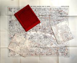 Post Office London Directory Street Plan Kelly's 1958 - 2 sheets each 100 x 84 & 1 sheet 96 x 80 cm This folding map is in three sections. The Central Area is on a large single sided sheet at approx 6 inches to 1 mile. The four outer sections are printed on two sides of large sheets at approx 3.6 inches to 1 mile. Paper slip case split on one edge. Larger image Ref uk703 : £20 Return to Great Britain & Ireland Index |
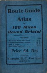 Route Guide and Atlas of 100 Miles Round Bristol Geographia Ltd. 1923 - 56 x 45 cm Card wrappers. 20pp maps of the greater South West reaches London and Derby. Large folded map (560 x 450 mm overall) on paper which has been somewhat repaired covers Newport, Stroud, Swindon, Salisbury, Bridgwater & Weston super Mare. A selection of cycling and motoring routes. Repairs to the folding map with paper tape. Larger image 1 : Larger Image 2 : Larger Image 3 : Larger Image 4 Ref uk1221 : £12 Return to Great Britain & Ireland Index |
 Vintage Ordnance Survey map 102 Newport (Rhymney to Caerwent). Ordnance Survey 1919/1940 - 63 x 84 cm 1 inch to 1 mile; 630 x 840 mm folded three times to 210 x 315 mm. 1919/1932. War Revision 1940. Mounted on cloth. This map was in use in World War 2 and was part of a complete map chest for England and Wales. It is therefore not new and may show signs of use such as creases, though the map surface is clean and without markings. See the area as it was three quarters of a century ago. Short closed marginal tear otherwise very good condition. Larger image Ref uk1533 : £4 Return to Great Britain & Ireland Index |
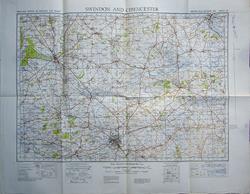 Vintage Ordnance Survey map 104 Swindon and Cirencester (Witney, Bibury and Wootton Bassett). Ordnance Survey 1941 - 64 x 86 cm 1 inch to 1 mile; 640 x 860 mm folded three times to 215 x 320 mm. Second War Revision 1941. This map was in use in World War 2 and was part of a complete map chest for England and Wales. It is therefore not new and may show signs of use such as creases, though the map surface is clean and without markings. See the area as it was three quarters of a century ago. Good condition. The map has been folded in other ways in the past. Small smudge in the lower left corner. Larger image Ref uk1535 : £2 Return to Great Britain & Ireland Index |
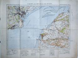 Vintage Ordnance Survey map 110 Cardiff and Severn Mouth (Barry, Portishead, Weston super Mare and Cheddar). Ordnance Survey 1941 - 64 x 86 cm 1 inch to 1 mile; 640 x 860 mm folded three times to 215 x 320 mm. Second War Revision 1941. This map was in use in World War 2 and was part of a complete map chest for England and Wales. It is therefore not new and may show signs of use such as creases, though the map surface is clean and without markings. See the area as it was three quarters of a century ago. Very good condition save for some marginal creasing and dusty left hand margin. Larger image Ref uk1541 : £4 Return to Great Britain & Ireland Index |
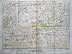 Vintage Ordnance Survey map 112 Marlborough (Wroughton, Lambourn, Hungerford and Devizes). Ordnance Survey 1942 - 56 x 76 cm 1 inch to 1 mile; 560 x 760 mm folded three times to 190 x 285 mm. Second War Revision 1942. This map was in use in World War 2 and was part of a complete map chest for England and Wales. It is therefore not new and may show signs of use such as creases, though the map surface is clean and without markings. See the area as it was three quarters of a century ago. Fair condition very creased. Larger image Ref uk1543 : £2 Return to Great Britain & Ireland Index |
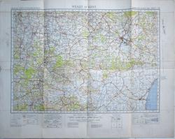 Vintage Ordnance Survey map 126 Weald of Kent (Horsmonden to Wye and New Romney). Ordnance Survey 1941 - 63 x 84 cm 1 inch to 1 mile; 630 x 840 mm folded three times to 210 x 320 mm. Second War Revision 1941. Mounted on cloth. This map was in use in World War 2 and was part of a complete map chest for England and Wales. It is therefore not new and may show signs of use such as creases, though the map surface is clean and without markings. See the area as it was three quarters of a century ago. Good to very good condition but some extra folds. Larger image Ref uk1557 : £3 Return to Great Britain & Ireland Index |
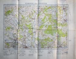 Vintage Ordnance Survey map 131 Wimborne and Ringwood (Tollard Royal to Romsey and Ringwood). Ordnance Survey 1940 - 64 x 86 cm 1 inch to 1 mile; 640 x 860 mm folded three times to 215 x 325 mm. War Office 1940. This map was in use in World War 2 and was part of a complete map chest for England and Wales. It is therefore not new and may show signs of use such as creases, though the map surface is clean and without markings. See the area as it was three quarters of a century ago. Very good condition save one pinhole in upper border. Larger image Ref uk1561 : £4 Return to Great Britain & Ireland Index |
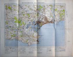 Vintage Ordnance Survey map 141 Bournemouth and Swanage (Wimborne and Wareham). Ordnance Survey 1941 - 64 x 86 cm 1 inch to 1 mile; 640 x 860 mm folded three times to 215 x 325 mm. Second War Revision 1941. This map was in use in World War 2 and was part of a complete map chest for England and Wales. It is therefore not new and may show signs of use such as creases, though the map surface is clean and without markings. See the area as it was three quarters of a century ago. Very good condition. Larger image Ref uk1567 : £5 Return to Great Britain & Ireland Index |
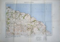 Vintage Ordnance Survey map 16 Whitby and Saltburn (Redcar to Goathland). Ordnance Survey 1925/1941 - 63.5 x 91 cm 1 inch to 1 mile; 635 x 910 mm folded three times to 240 x 335 mm. 1925. Second War Revision 1941. Mounted on cloth. This map was in use in World War 2 and was part of a complete map chest for England and Wales. It is therefore not new and may show signs of use such as creases, though the map surface is clean and without markings. See the area as it was three quarters of a century ago. Good condition. Larger image Ref uk1459 : £4 Return to Great Britain & Ireland Index |
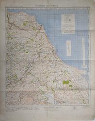 Vintage Ordnance Survey map 1A Berwick on Tweed (St. Abb s Head to Holy Island). Ordnance Survey 1941 - 67 x 85 cm 1 inch to 1 mile; 670 x 850 mm folded three times to 220 x 340 mm. War Revision 1941. Mounted on cloth. This map was in use in World War 2 and was part of a complete map chest for England and Wales. It is therefore not new and may show signs of use such as creases, though the map surface is clean and without markings. See the area as it was three quarters of a century ago. Good condition; blank margins a little scruffy with one short edge tear. Larger image Ref uk1569 : £4 Return to Great Britain & Ireland Index |
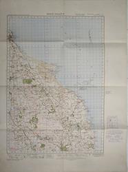 Vintage Ordnance Survey map 2 Holy Island (Berwick on Tweed to Howick). Ordnance Survey 1925/1932 - 63.5 x 88 cm 1 inch to 1 mile; 635 x 880 mm folded three times to 220 x 320 mm. 1925/1932. Mounted on cloth. This map was in use in World War 2 and was part of a complete map chest for England and Wales. It is therefore not new and may show signs of use such as creases, though the map surface is clean and without markings. See the area as it was three quarters of a century ago. Very good condition; blank margins a trifle scruffy. Larger image Ref uk1446 : £4 Return to Great Britain & Ireland Index |
 Vintage Ordnance Survey map 21 Ripon and North Allerton (Reeth to Ramsgill). Ordnance Survey 1921/1932. - 60.5 x 81 cm 1 inch to 1 mile; 605 x 810 mm folded three times to 200 x 305 mm. 1921/1929/1932. Mounted on cloth. This map was in use in World War 2 and was part of a complete map chest for England and Wales. It is therefore not new and may show signs of use such as creases, though the map surface is clean and without markings. See the area as it was three quarters of a century ago. Good condition with some toned folds. Larger image Ref uk1463 : £4 Return to Great Britain & Ireland Index |
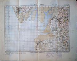 Vintage Ordnance Survey map 24 Lancaster and Barrow (Carnforth to Fleetwood). Ordnance Survey 1925/1940 - 63 x 84 cm 1 inch to 1 mile; 630 x 840 mm folded three times to 210 x 320 mm. 1925/1932. War Revision 1940. This map was in use in World War 2 and was part of a complete map chest for England and Wales. It is therefore not new and may show signs of use such as creases, though the map surface is clean and without markings. See the area as it was three quarters of a century ago. Good condition. Larger image Ref uk1467 : £3 Return to Great Britain & Ireland Index |
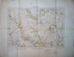 Vintage Ordnance Survey map 26 Harrogate (Skipton to Wetherby). Ordnance Survey 1940 - 69 x 91 cm 1 inch to 1 mile; 690 x 910 mm folded three times to 230 x 345 mm. Second War Revision 1940. Mounted on cloth. This map was in use in World War 2 and was part of a complete map chest for England and Wales. It is therefore not new and may show signs of use such as creases, though the map surface is clean and without markings. See the area as it was three quarters of a century ago. Good condition. Larger image Ref uk1468 : £3 Return to Great Britain & Ireland Index |
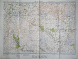 Vintage Ordnance Survey map 3 Cheviot Hills (Hobkirk to Elsdon). Ordnance Survey 1942 - 56 x 76 cm 1 inch to 1 mile; 560 x 760 mm folded three times to 190 x 280 mm. Second War Revision 1942. This map was in use in World War 2 and was part of a complete map chest for England and Wales. It is therefore not new and may show signs of use such as creases, though the map surface is clean and without markings. See the area as it was three quarters of a century ago. Very good condition; lower blank margin a little creased. Larger image Ref uk1447 : £4 Return to Great Britain & Ireland Index |
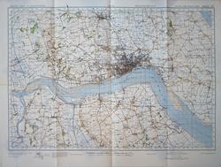 Vintage Ordnance Survey map 33 Hull (Beverley to Flixborough). Ordnance Survey 1941 - 56 x 76 cm 1 inch to 1 mile; 560 x 760 mm folded three times to 190 x 285 mm. Second War Revision 1941. This map was in use in World War 2 and was part of a complete map chest for England and Wales. It is therefore not new and may show signs of use such as creases, though the map surface is clean and without markings. See the area as it was three quarters of a century ago. Very good condition almost fine. Larger image Ref uk1473 : £6 Return to Great Britain & Ireland Index |
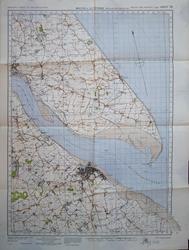 Vintage Ordnance Survey map 34 Mouth of the Humber (Withernsea and Grimsby). Ordnance Survey 1941 - 63 x 84 cm 1 inch to 1 mile; 630 x 840 mm folded three times to 210 x 300 mm. Second War Revision 1941. This map was in use in World War 2 and was part of a complete map chest for England and Wales. It is therefore not new and may show signs of use such as creases, though the map surface is clean and without markings. See the area as it was three quarters of a century ago. Very good condition. Larger image Ref uk1474 : £5 Return to Great Britain & Ireland Index |
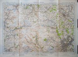 Vintage Ordnance Survey map 37 Barnsley and Sheffield (Holmfirth and New Mills). Ordnance Survey 1942 - 56 x 76 cm 1 inch to 1 mile; 560 x 760 mm folded three times to 195 x 285 mm. Second War Revision 1942. This map was in use in World War 2 and was part of a complete map chest for England and Wales. It is therefore not new and may show signs of use such as creases, though the map surface is clean and without markings. See the area as it was three quarters of a century ago. Very good condition save for one short marginal tear and some creasing and denting of the lower left panel. Larger image Ref uk1477 : £4 Return to Great Britain & Ireland Index |
 Vintage Ordnance Survey map 39 Scunthorpe and Market Raisen (Grimsby and Caistor). Ordnance Survey 1940 - 56 x 76 cm 1 inch to 1 mile; 560 x 760 mm folded three times to 190 x 280 mm. Second War Revision 1940. This map was in use in World War 2 and was part of a complete map chest for England and Wales. It is therefore not new and may show signs of use such as creases, though the map surface is clean and without markings. See the area as it was three quarters of a century ago. Very good condition almost fine. Larger image Ref uk1479 : £6 Return to Great Britain & Ireland Index |
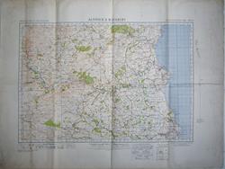 Vintage Ordnance Survey map 4 Alnwick and Rothbury (Harbottle to Ashington). Ordnance Survey 1941 - 68.5 x 90 cm 1 inch to 1 mile; 685 x 900 mm folded three times to 230 x 345 mm. Second War Revision 1941. Mounted on cloth. This map was in use in World War 2 and was part of a complete map chest for England and Wales. It is therefore not new and may show signs of use such as creases, though the map surface is clean and without markings. See the area as it was three quarters of a century ago. Very good condition; blank margins a little scruffy. Larger image Ref uk1448 : £4 Return to Great Britain & Ireland Index |
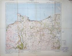 Vintage Ordnance Survey map 42 Llandudno and Denbigh (Rhyl and Llanrwst). Ordnance Survey 1922/1940 - 68.5x 91 cm 1 inch to 1 mile; 685 x 910 mm folded three times to 230 x 340 mm. 1922/1932. War Revision 1940. Mounted on cloth. This map was in use in World War 2 and was part of a complete map chest for England and Wales. It is therefore not new and may show signs of use such as creases, though the map surface is clean and without markings. See the area as it was three quarters of a century ago. Very good condition save for a little marginal scruffiness. Larger image Ref uk1481 : £4 Return to Great Britain & Ireland Index |
 Vintage Ordnance Survey map 50 Bala (Blaenau-Ffestiniog to Corwen). Ordnance Survey 1921/1940 - 64 x 83 cm 1 inch to 1 mile; 640 x 830 mm folded three times to 210 x 320 mm. 1921/1932. War Revision 1940. This map was in use in World War 2 and was part of a complete map chest for England and Wales. It is therefore not new and may show signs of use such as creases, though the map surface is clean and without markings. See the area as it was three quarters of a century ago. Very good condition save for some creases in the margin corners. Larger image Ref uk1488 : £4 Return to Great Britain & Ireland Index |
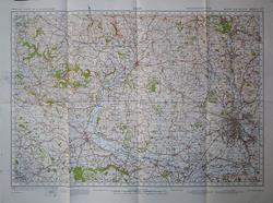 Vintage Ordnance Survey map 53 Derby (Cheadle to Ripley). Ordnance Survey 1942 - 56 x 76 cm 1 inch to 1 mile; 560 x 760 mm folded three times to 190 x 285 mm. Second War Revision 1942. This map was in use in World War 2 and was part of a complete map chest for England and Wales. It is therefore not new and may show signs of use such as creases, though the map surface is clean and without markings. See the area as it was three quarters of a century ago. Very good condition. Larger image Ref uk1489 : £5 Return to Great Britain & Ireland Index |
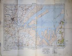 Vintage Ordnance Survey map 56 Boston (Hunstanton; the Wash). Ordnance Survey 1940 - 64 x 83 cm 1 inch to 1 mile; 640 x 830 mm folded three times to 210 x 320 mm. Second War Revision 1940. This map was in use in World War 2 and was part of a complete map chest for England and Wales. It is therefore not new and may show signs of use such as creases, though the map surface is clean and without markings. See the area as it was three quarters of a century ago. Very good condition. Larger image Ref uk1492 : £5 Return to Great Britain & Ireland Index |
 Vintage Ordnance Survey map 62 Burton and Walsall (Rugeley to Atherstone). Ordnance Survey 1932/1940 - 63 x 88 cm 1 inch to 1 mile; 630 x 880 mm unusually folded five times to 190 x 290 mm. 1932. War Revision 1940. This map was in use in World War 2 and was part of a complete map chest for England and Wales. It is therefore not new and may show signs of use such as creases, though the map surface is clean and without markings. See the area as it was three quarters of a century ago. Very good condition save for the extra folds and ink marks in the wide blank right margin Larger image Ref uk1497 : £4 Return to Great Britain & Ireland Index |
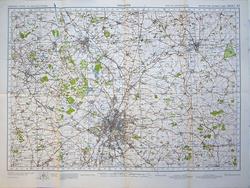 Vintage Ordnance Survey map 63 Leicester (Loughborough, Melton Mowbray). Ordnance Survey 1942 - 56 x 76 cm 1 inch to 1 mile; 560 x 760 mm folded three times to 190 x 280 mm. Second War Revision 1942. This map was in use in World War 2 and was part of a complete map chest for England and Wales. It is therefore not new and may show signs of use such as creases, though the map surface is clean and without markings. See the area as it was three quarters of a century ago. Very good condition almost fine. Larger image Ref uk1498 : £6 Return to Great Britain & Ireland Index |
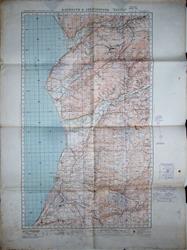 Vintage Ordnance Survey map 68 Barmouth and Aberystwyth (Dolgellau to Yspytty Ystwyth). Ordnance Survey 1932 - 67 x 94.5 cm 1 inch to 1 mile; 670 x 945 mm folded three times to 240 x 340 mm. 1932. Printed on type of waxed paper. This map was in use in World War 2 and was part of a complete map chest for England and Wales. It is therefore not new and may show signs of use such as creases, though the map surface is clean and without markings. See the area as it was three quarters of a century ago. Very good condition save for a few dirty scuffs in lower margins. Larger image Ref uk1503 : £4 Return to Great Britain & Ireland Index |
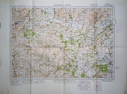 Vintage Ordnance Survey map 70 Bishop s Castle (Montgomery and Newtown to Knighton and Ludlow). Ordnance Survey 1920/1940 - 64 x 86 cm 1 inch to 1 mile; 640 x 860 mm folded three times to 215 x 320 mm. 1920/1932. War Revision 1940. This map was in use in World War 2 and was part of a complete map chest for England and Wales. It is therefore not new and may show signs of use such as creases, though the map surface is clean and without markings. See the area as it was three quarters of a century ago. Very good condition with just a little creasing to a margin. Larger image Ref uk1504 : £6 Return to Great Britain & Ireland Index |
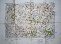 Vintage Ordnance Survey map 70 Bishop s Castle (Montgomery and Newtown to Knighton and Ludlow). Ordnance Survey 1920/1940 - 64 x 86 cm 1 inch to 1 mile; 640 x 860 mm folded three times to 215 x 320 mm. 1920/1932. War Revision 1940. This map was in use in World War 2 and was part of a complete map chest for England and Wales. It is therefore not new and may show signs of use such as creases, though the map surface is clean and without markings. See the area as it was three quarters of a century ago. Fine condition. Larger image Ref uk1505 : £6 Return to Great Britain & Ireland Index |
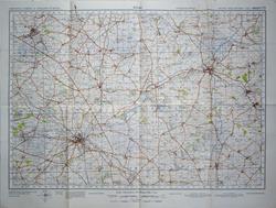 Vintage Ordnance Survey map 73 Rugby (Hinckley to Desborough). Ordnance Survey 1941 - 56 x 76 cm 1 inch to 1 mile; 560 x 760 mm folded three times to 200 x 285 mm. Second War Revision 1941. This map was in use in World War 2 and was part of a complete map chest for England and Wales. It is therefore not new and may show signs of use such as creases, though the map surface is clean and without markings. See the area as it was three quarters of a century ago. Fine condition. Larger image Ref uk1508 : £6 Return to Great Britain & Ireland Index |
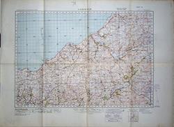 Vintage Ordnance Survey map 78 Lampeter (Llanrhystyd, Newquay, Aberporth). Ordnance Survey 1885/1932 - 63.5 x 88 cm 1 inch to 1 mile; 635 x 880 mm folded three times to 220 x 320 mm. Surveyed 1885-8. 3rd Revision 1919/1932. This map was in use in World War 2 and was part of a complete map chest for England and Wales. It is therefore not new and may show signs of use such as creases, though the map surface is clean and without markings. See the area as it was three quarters of a century ago. Very good condition save dusty margins. Larger image Ref uk1513 : £4 Return to Great Britain & Ireland Index |
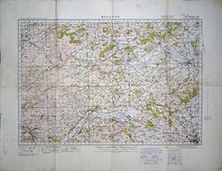 Vintage Ordnance Survey map 80 Kington (Leominster, Presteign and Hay). Ordnance Survey 1920/1941 - 64 x 83 cm 1 inch to 1 mile; 640 x 830 mm folded three times to 215 x 330 mm. 1920/1932. Second War Revision 1941. This map was in use in World War 2 and was part of a complete map chest for England and Wales. It is therefore not new and may show signs of use such as creases, though the map surface is clean and without markings. See the area as it was three quarters of a century ago. Good to very good condition but margins scruffy and creased. Larger image Ref uk1515 : £3 Return to Great Britain & Ireland Index |
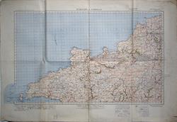 Vintage Ordnance Survey map 88 St David s and Cardigan (Fishguard and Ramsey Island). Ordnance Survey 1923/1941 - 67.5 x 101 cm 1 inch to 1 mile; 675 x 1010 mm folded three times to 250 x 345 mm. 1923/1932. Second War Revision 1941. Mounted on cloth. This map was in use in World War 2 and was part of a complete map chest for England and Wales. It is therefore not new and may show signs of use such as creases, though the map surface is clean and without markings. See the area as it was three quarters of a century ago. Good to very good condition but has been curved at one side when folded and needs flattening. See images. Larger image Ref uk1520 : £3 Return to Great Britain & Ireland Index |
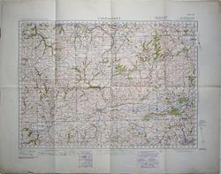 Vintage Ordnance Survey map 89 Carmarthen (Newcastle Emlyn to Ammanford). Ordnance Survey 1923/1940 - 67 x 85 cm 1 inch to 1 mile; 670 x 850 mm folded three times to 220 x 330 mm. 1923/1931. War Revision 1940. Mounted on cloth. This map was in use in World War 2 and was part of a complete map chest for England and Wales. It is therefore not new and may show signs of use such as creases, though the map surface is clean and without markings. See the area as it was three quarters of a century ago. Very good condition. Larger image Ref uk1521 : £5 Return to Great Britain & Ireland Index |
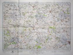 Vintage Ordnance Survey map 94 Bicester (Brackley, Woodstock, Buckingham and Aylesbury). Ordnance Survey 1941 - 56 x 76 cm 1 inch to 1 mile; 560 x 760 mm folded three times to 190 x 285 mm. Second War Revision 1941. This map was in use in World War 2 and was part of a complete map chest for England and Wales. It is therefore not new and may show signs of use such as creases, though the map surface is clean and without markings. See the area as it was three quarters of a century ago. Fine condition. Larger image Ref uk1526 : £6 Return to Great Britain & Ireland Index |
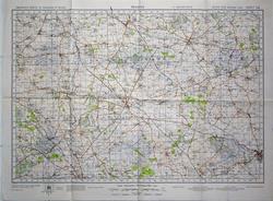 Vintage Ordnance Survey map 94 Bicester (Brackley, Woodstock, Buckingham and Aylesbury). Ordnance Survey 1941 - 56 x 76 cm 1 inch to 1 mile; 560 x 760 mm folded three times to 190 x 285 mm. Second War Revision 1941. This map was in use in World War 2 and was part of a complete map chest for England and Wales. It is therefore not new and may show signs of use such as creases, though the map surface is clean and without markings. See the area as it was three quarters of a century ago. Very good condition - almost fine. Larger image Ref uk1527 : £6 Return to Great Britain & Ireland Index |
 Vintage Ordnance Survey map: England, South. Ordnance Survey 1940 - 86 x 64 cm MILITARY EDITION. NOT TO BE PUBLISHED. War Revision 1940. Based on the OS fourth edition. Air information correct to 20/11/39. Marked with Land Aerodromes; Landing Grounds; Water Aerodromes & Seaplane Mooring Areas or Anchorages. Airship Bases. SOME 30 AIRFIELDS NAMED. Paper. This map was in use in World War 2 and was part of a complete map chest for England and Wales. It is therefore not new and may show signs of use such as creases, though the map surface is clean and without markings. See the area as it was three quarters of a century ago. A little scruffy; especially on the blank back. Larger image Ref uk1700 : £12 Return to Great Britain & Ireland Index |
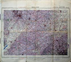 Vintage Ordnance Survey map: Midlands. Ordnance Survey 1943 - 76 x 65 cm MILITARY. 2nd War Revision. Quarter inch to one mile. Compiled and photolithographed by OS 1943. Based on the OS fourth edition. Areas dangerous to flying are not indicated on this map. A coloured overlay, whose depth increases with height, emphasises the height of hills. Certain main spot heights are indicated white tab to improve legibility. MORE THAN 110 AIRFIELDS NAMED. Published by the War Office. This map was in use in World War 2 and was part of a complete map chest for England and Wales. It is therefore not new and may show signs of use such as creases, though the map surface is clean and without markings. See the area as it was three quarters of a century ago. Crisp paper copy with three small holes on the fold points and the margins a bit scruffy and creased. Larger image Ref uk1697 : £10 Return to Great Britain & Ireland Index |
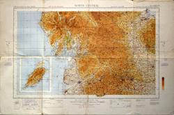 Vintage Ordnance Survey map: North Central. Inset of the Isle of Man. Ordnance Survey 1940 - 100 x 65 cm MILITARY EDITION. NOT TO BE PUBLISHED. War Revision 1940. Based on the OS fourth edition. Air information correct to 20/11/39. Marked with Land Aerodromes; Landing Grounds; Water Aerodromes & Seaplane Mooring Areas or Anchorages. Airship Bases. AROUND 10 AIRFIELDS NAMED. Mounted on cloth. This map was in use in World War 2 and was part of a complete map chest for England and Wales. It is therefore not new and may show signs of use such as creases, though the map surface is clean and without markings. See the area as it was three quarters of a century ago. Worn along the fold lines. Larger image Ref uk1692 : £8 Return to Great Britain & Ireland Index |
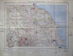 Vintage Ordnance Survey map: North East England. Ordnance Survey 1940 - 83 x 63 cm MILITARY EDITION. NOT TO BE PUBLISHED. War Revision 1940. Based on the OS fourth edition. Air information correct to 20/11/39. Marked with Land Aerodromes; Landing Grounds; Water Aerodromes & Seaplane Mooring Areas or Anchorages. Airship Bases. AROUND 12 AIRFIELDS NAMED. Mounted on cloth. This map was in use in World War 2 and was part of a complete map chest for England and Wales. It is therefore not new and may show signs of use such as creases, though the map surface is clean and without markings. See the area as it was three quarters of a century ago. Tear in blank margin. Larger image Ref uk1693 : £10 Return to Great Britain & Ireland Index |
 Vintage Ordnance Survey map: North Midlands & Lincolnshire. Ordnance Survey 1943 - 94 x 70 cm MILITARY. 2nd War Revision. Quarter inch to one mile. Compiled and photolithographed by OS 1943. Based on the OS fourth edition. Areas dangerous to flying are not indicated on this map. A coloured overlay, whose depth increases with height, emphasises the height of hills. Certain main spot heights are indicated white tab to improve legibility. AROUND 90 AIRFIELDS NAMED. Published by the War Office. This map was in use in World War 2 and was part of a complete map chest for England and Wales. It is therefore not new and may show signs of use such as creases, though the map surface is clean and without markings. See the area as it was three quarters of a century ago. Crisp paper copy with a little of top right margin missing. Larger image Ref uk1695 : £15 Return to Great Britain & Ireland Index |
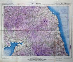 Vintage Ordnance Survey map: The Border. Ordnance Survey 1943 - 76 x 64 cm MILITARY. 2nd War Revision. Quarter inch to one mile. Compiled and photolithographed by OS 1943. Based on the OS fourth edition. Areas dangerous to flying are not indicated on this map. A coloured overlay, whose depth increases with height, emphasises the height of hills. Certain main spot heights are indicated white tab to improve legibility. Strong emphasis on magnetic variation across the sheet. SOME 20 AIRFIELDS NAMED. Published by the War Office. This map was in use in World War 2 and was part of a complete map chest for England and Wales. It is therefore not new and may show signs of use such as creases, though the map surface is clean and without markings. See the area as it was three quarters of a century ago. Crisp paper copy with just a little marginal creasing. Larger image Ref uk1691 : £15 Return to Great Britain & Ireland Index |
|||
| |||