| Home Page | Buying | Maps | Books | Prints | Ephemera |
- Home Page
- England & Wales County Maps Anglesea - Dorset
- England & Wales County Maps Durham - Merioneth
- England & Wales County Maps Midd'x - Somerset
- England & Wales County Maps Staffs - Yorks
- British Isles: Physical, Railways, Statistical, etc. Roman Britain
- England & Wales, Countries, Islands, Regions inc. the Lake District, Road & Rail Maps
- Scotland, the Country & Regions: Town Plans & Environs; Rail Maps
- Ireland, the Country, Regions & Environs
- England & Wales, Town Plans & Maps of Environs
- Ordnance Survey and Folding Maps
There are 10 pages of maps of the British Isles. Please see the index on the Great Britain page to gain access to 1000 maps of England, Wales, Scotland and Ireland.
All our maps are Originals, NOT modern reproductions and have thumbnails as well as larger images so it is easy to find what you are looking for.
If you want several items, email me for a discount!
Email: don@theoldmapman.com
> Section 1 > Section 2
 Scotland: Iona From Black's Guide to Scotland 1901 - 11 x 16.5 cm Original antique coloured map. Larger image Ref uk1899 : £6 Return to Great Britain & Ireland Index |
 Scotland: Jura, Colonsay, etc. From Black's Guide to Scotland 1901 - 23 x 16.5 cm Original antique coloured map. Two original folds. Larger image Ref uk1898 : £6 Return to Great Britain & Ireland Index |
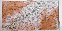 Scotland: Kingussie District From Black's Guide to Scotland 1900 - 31 x 16 cm Original antique coloured map. Three original folds. Larger image Ref uk1919 : £4 Return to Great Britain & Ireland Index |
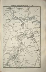 Scotland: Lanark & Falls of Clyde J Bartholomew 1879 - 9 x 14.5 cm For A & C Black's Picturesque Tourist of Scotland Larger image Ref uk1398 : £4 Return to Great Britain & Ireland Index |
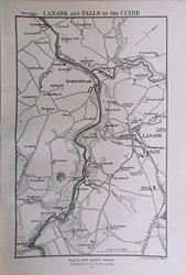 Scotland: Lanark & Falls of the Clyde From Black's Guide to Scotland 1901 - 11 x 16.5 cm Original antique engraved map. Larger image Ref uk1874 : £5 Return to Great Britain & Ireland Index |
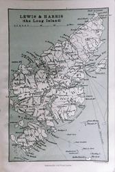 Scotland: Lewis & Harris From Black's Guide to Scotland 1901 - 11 x 16.5 cm Original antique coloured map. Larger image Ref uk1900 : £5 Return to Great Britain & Ireland Index |
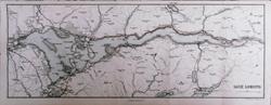 Scotland: Loch Lomond From Black's Guide to Scotland 1901 - 43 x 16.5 cm Original antique coloured map. Four original folds. Larger image Ref uk1901 : £7 Return to Great Britain & Ireland Index |
 Scotland: Loch Lomond J Bartholomew 1879 - 41 x 14.5 cm For A & C Black's Picturesque Tourist of Scotland. Four original folds. Larger image Ref uk1392 : £6 Return to Great Britain & Ireland Index |
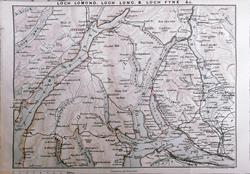 Scotland: Loch Lomond, Loch Long & Loch Fyne, etc. From Black's Guide to Scotland 1901 - 23 x 16.5 cm Original antique coloured map. Two original folds. Larger image Ref uk1902 : £5 Return to Great Britain & Ireland Index |
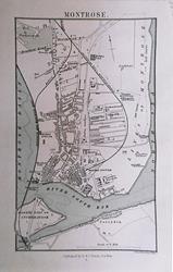 Scotland: Montrose From Black's Guide to Scotland 1901 - 11 x 16.5 cm Original antique engraved map. Larger image Ref uk1875 : £6 Return to Great Britain & Ireland Index |
 Scotland: North Sidney Hall 1859 - 59 x 41.5 cm Large double page coloured map of Northern Scotland and the Hebrides with insert of Orkney Isles. There is a single small closed worm hole near the centrefold and a 15mm closed split at the foot of the centrefold. Larger image Ref uk1601 : £12 Return to Great Britain & Ireland Index |
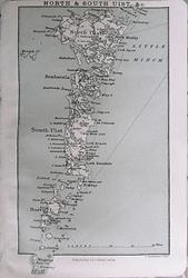 Scotland: North & South Uist From Black's Guide to Scotland 1901 - 11 x 16.5 cm Original antique coloured map. Larger image Ref uk1912 : £5 Return to Great Britain & Ireland Index |
 Scotland: North British Railway: Edinburgh to Berwick J Bartholomew 1879 - 26 x 14.5 cm For A & C Black's Picturesque Tourist of Scotland. Two original folds. Larger image Ref uk1369 : £6 Return to Great Britain & Ireland Index |
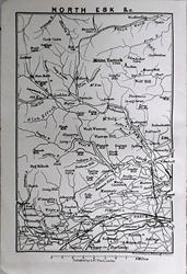 Scotland: North Esk From Black's Guide to Scotland 1901 - 11 x 16.5 cm Original antique map. Larger image Ref uk1891 : £3 Return to Great Britain & Ireland Index |
 Scotland: Northern Scotland with the Orkneys and Shetlands. Geo. Philip c1907 - 35.5 x 23.5 cm Large original antique coloured map. Larger image Ref uk1781 : £9 Return to Great Britain & Ireland Index |
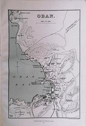 Scotland: Oban From Black's Guide to Scotland 1901 - 11 x 16.5 cm Original antique engraved map. Larger image Ref uk1876 : £7 Return to Great Britain & Ireland Index |
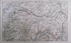 Scotland: Oban District From Black's Guide to Scotland 1901 - 27 x 16.5 cm Original antique coloured map. Two original folds. Larger image Ref uk1904 : £6 Return to Great Britain & Ireland Index |
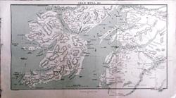 Scotland: Oban, Mull, etc, From Black's Guide to Scotland 1901 - 28.5 x 16.5 cm Original antique coloured map. Two original folds. Larger image Ref uk1903 : £6 Return to Great Britain & Ireland Index |
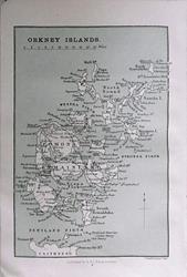 Scotland: Orkney Islands From Black's Guide to Scotland 1901 - 11 x 16.5 cm Original antique coloured map. Larger image Ref uk1905 : £4 Return to Great Britain & Ireland Index |
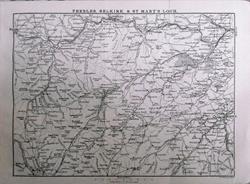 Scotland: Peebles, Selkirk & St. Mary's Loch From Black's Guide to Scotland 1901 - 22 x 16.5 cm Original antique coloured map. Two original folds. Larger image Ref uk1906 : £4 Return to Great Britain & Ireland Index |
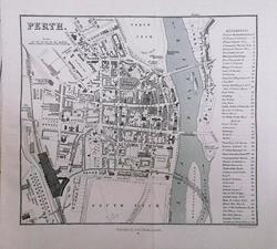 Scotland: Perth From Black's Guide to Scotland 1901 - 18 x 16.5 cm Original antique engraved map. One original fold. Larger image Ref uk1877 : £9 Return to Great Britain & Ireland Index |
 Scotland: Railway Systems, North & Central. Geo. Philip c1907 - 23 x 36 cm Large coloured map. Table of Reference to track colours of 6 Railway Companies. Larger image Ref uk1671 : £8 Return to Great Britain & Ireland Index |
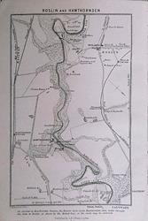 Scotland: Roslin & Hawthornden From Black's Guide to Scotland 1901 - 11 x 16.5 cm Original antique engraved map. Larger image Ref uk1878 : £3 Return to Great Britain & Ireland Index |
 Scotland: Scotia pars Australior .. (The South pt of Scotland wherin are contayned Edinbrough, St. Andrew and Glasco Archbisho) van den Keere 1617 - 12 x 8.5 cm Original antique map with Latin text verso. Published by W J Blaeu. The map is signed Patrus Kaerius caelavit. Larger image Ref uk1821 : £54 Return to Great Britain & Ireland Index |
 Scotland: Scotia pars Australissima .. (The Southren parte of Scotland, wherin is ye Strange Lake Lomund) van den Keere 1617 - 12 x 8.5 cm Original antique map with Latin text verso. Published by W J Blaeu. The map is signed Patrus Kaerius caelavit. The map has some toning. Top right corner fragile. Larger image Ref uk1822 : £49 Return to Great Britain & Ireland Index |
 Scotland: Scotia pars Orientalior .. (The Eastern part of Scotland wherin ther are diuers Shires and the Vniversity of Aberdyn) van den Keere 1617 - 12 x 8.5 cm Original antique map with Latin text verso. Published by W J Blaeu. The map is signed Patrus Kaerius caelavit. The map has light toning. Larger image Ref uk1823 : £54 Return to Great Britain & Ireland Index |
 Scotland: Scotia pars quae incolis Stratnahern vocatur .. (Part of Scotland, it is called of the inhabitance of Stranauerre with his borderers) van den Keere 1617 - 12 x 8.5 cm Original antique map with Latin text verso. Published by W J Blaeu. The map is signed Patrus Kaerius caelavit 1599. The map has some toning. Larger image Ref uk1826 : £54 Return to Great Britain & Ireland Index |
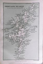 Scotland: Shetland Islands From Black's Guide to Scotland 1901 - 11 x 16.5 cm Original antique coloured map. Larger image Ref uk1908 : £4 Return to Great Britain & Ireland Index |
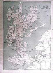 Scotland: Skye, with the adjacent Coasts & Islands From Black's Guide to Scotland 1901 - 26.5 x 37 cm Original antique coloured map. Several original folds. Larger image Ref uk1909 : £12 Return to Great Britain & Ireland Index |
 Scotland: South Sidney Hall 1859 - 58 x 41.5 cm Large double page coloured map with insert of Shetland Isles. There is a single small closed worm hole near the centrefold. Larger image Ref uk1602 : £12 Return to Great Britain & Ireland Index |
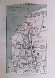 Scotland: St. Andrews From Black's Guide to Scotland 1901 - 11 x 16.5 cm Original antique engraved map. Larger image Ref uk1879 : £7 Return to Great Britain & Ireland Index |
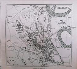 Scotland: Stirling From Black's Guide to Scotland 1901 - 18 x 16.5 cm Original antique engraved map. One original fold. Larger image Ref uk1880 : £9 Return to Great Britain & Ireland Index |
 Scotland: Stirling J Bartholomew 1879 - 16 x 15 cm For A & C Black's Picturesque Tourist of Scotland. Centrefold. Toning along centrefold. Larger image Ref uk1382 : £7 Return to Great Britain & Ireland Index |
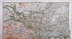 Scotland: Strathpeffer District From Black's Guide to Scotland 1900 - 29 x 16 cm Original antique coloured map. Three original folds. Larger image Ref uk1920 : £3 Return to Great Britain & Ireland Index |
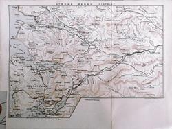 Scotland: Strome Ferry District From Black's Guide to Scotland 1901 - 28 x 21 cm Original antique coloured map. Several original folds. Larger image Ref uk1910 : £6 Return to Great Britain & Ireland Index |
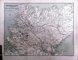 Scotland: Sutherland with parts of Ross & Caithness Shires From Black's Guide to Scotland 1901 - 27 x 21 cm Original antique coloured map. Several original folds. A long tear across the top left corner has been repaired with paper tape. Larger image Ref uk1911 : £4 Return to Great Britain & Ireland Index |
 Scotland: The Borders Hughes for Virtue & Co. 1873 - 30 x 24 cm Colour printed map of Roxburgh, Berwick, Selkirk and Peebles showing roads and railways. Larger image Ref uk728 : £6 Return to Great Britain & Ireland Index |
 Scotland: The East. Verso: The North. W & A K Johnston 1897 - 20 x 26 cm East Scotland from the Moray Firth to the Firth of Tay, including, of course, Aberdeen. Verso: The North of Scotland from Loch Ness to Cape Wrath. Fine outline coloured maps. Two images available. Larger image 1 : Larger Image 2 Ref uk709 : £8 Return to Great Britain & Ireland Index |
 Scotland: The Highlands. Geo. Philip c1907 - 48 x 35 cm Very large double page coloured map, with centrefold. Inset of the Tay ports. Larger image Ref uk1673 : £12 Return to Great Britain & Ireland Index |
 Scotland: The Trossachs and South West from Clyde to the Forth Hughes for Virtue & Co. 1868 - 30 x 24 cm Colour printed map of Stirling, Dumbarton, Renfrew and parts of Lanark and Ayr showing roads and railways. Larger image Ref uk729 : £6 Return to Great Britain & Ireland Index |
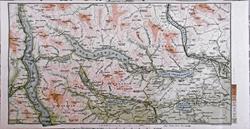 Scotland: The Trossachs District From Black's Guide to Scotland 1900 - 29 x 16 cm Original antique coloured map. Three original folds. Larger image Ref uk1921 : £6 Return to Great Britain & Ireland Index |
 Scotland: The Trossachs. Verso: Callander & Oban Railway J Bartholomew 1879 - 8 x 14.5 cm For A & C Black's Picturesque Tourist of Scotland Larger image 1 : Larger Image 2 Ref uk1375 : £4 Return to Great Britain & Ireland Index |
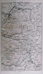 Scotland: West Highland Railway From Black's Guide to Scotland 1901 - 16 x 27 cm Original antique coloured map. Two original folds. Larger image Ref uk1913 : £5 Return to Great Britain & Ireland Index |
|
> Section 1 > Section 2 | |||